Abstract
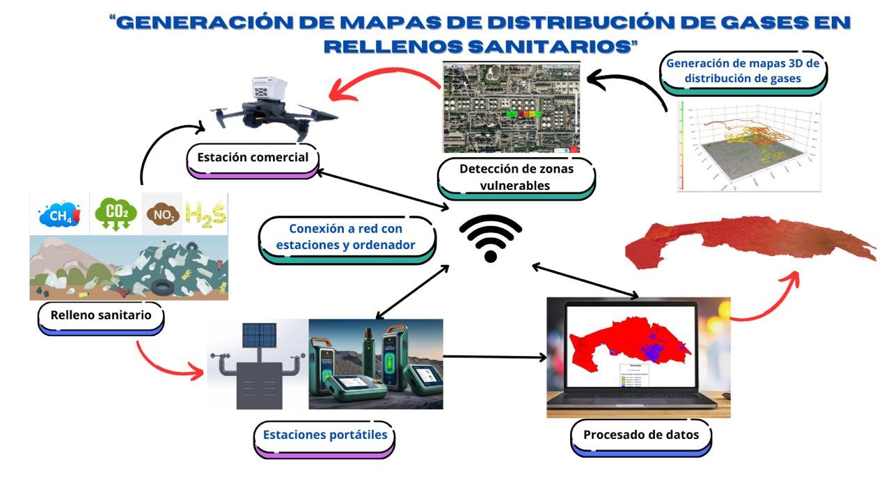
The present study aims to demonstrate the effectiveness of applying a method for estimating and measuring pollutant gases in landfills (LF) based on the analysis of environmental monitoring data and sensors. The methodology of this research focuses on the collection of information to identify the emission patterns of pollutant gases that allow the generation of 3D maps of point clouds of their distribution. As well as developing predictive models that allow the implementation of strategies that are effective in mitigating the impacts of climate change by identifying vulnerable areas, i.e., areas with higher concentration of gases.
This technique will be implemented in the landfills “Bordo Poniente” and “Bordo Xochiaca”, it is worth mentioning that the first of these is the largest landfill in Latin America, although it was suspended in December 2011, polluting gases are still emitted without control or monitoring of air quality, thus causing health risks.
The strategy considered in this analysis is composed of data collection from portable environmental monitoring stations and their validation with a commercial system, data cleaning and processing, as well as temporal and spatial analysis of the concentrations of polluting gases such as: carbon dioxide, nitrogen dioxide, methane and hydrogen sulfide